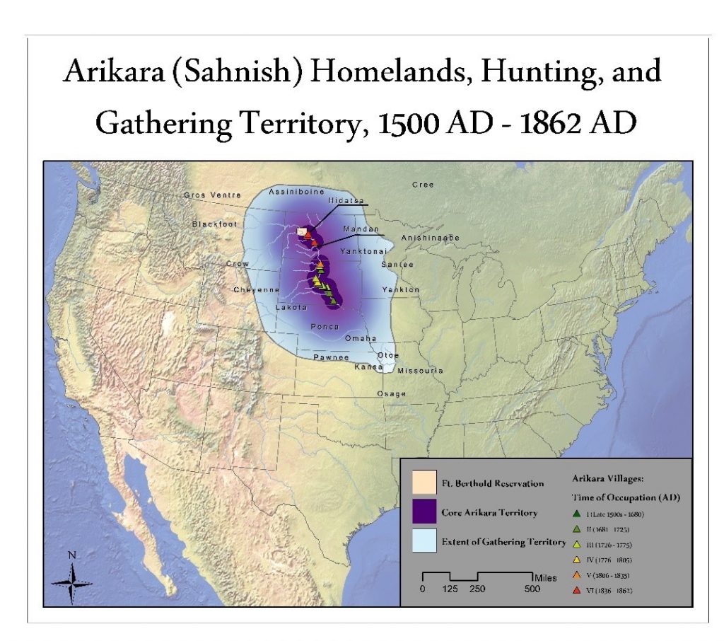
Figure 1. Before the Arikara Nation was forced onto the Ft. Berthold Reservation with the Hidatsa and Mandan Nations, they accessed an extensive territory surrounding the middle Missouri River region. The core Arikara Territory, in dark purple, is the most intensively used area, and is composed of land used frequently, up to 40 miles from their villages. The village sites of the middle Missouri region show the most extensively used territory known and these are divided into six historical periods based on dated artifacts. The color of the village sites follow a migration south to north as the Arikara separated from the Pawnee and continued north until