Physalis Longifolia maps
The maps on this page show the range of North American Physalis species and their cultural use. Click on the link for each map for a larger image.

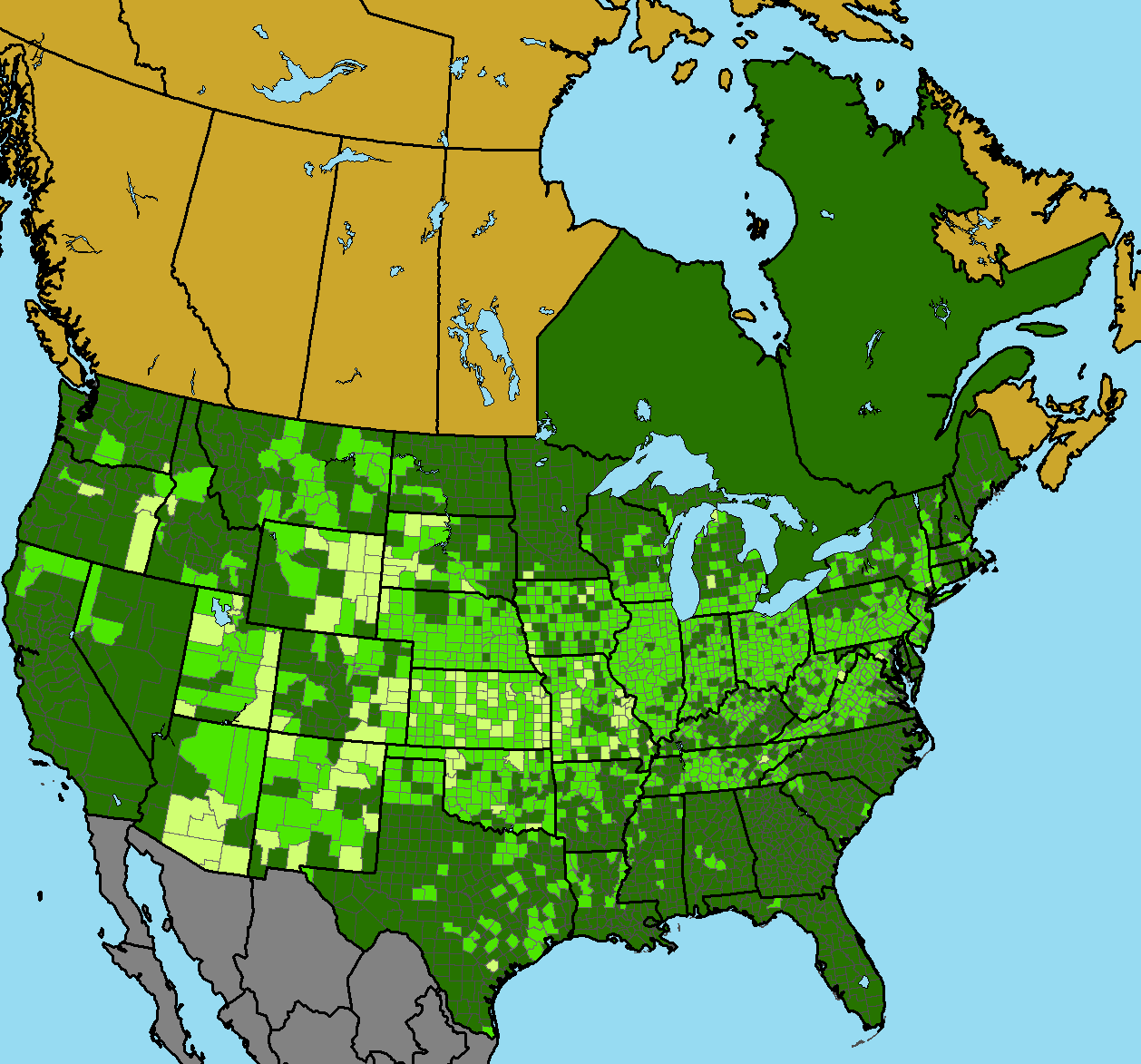
Map 1. Distribution of Physalis longifolia
Map 1, from the Biota of North America Program (BONAP), shows the distribution of Physalis longifolia. Yellow counties are where specific locations of Physalis longifolia are known accurately to within a few meters. Light green counties are where plants are known to occur in the county. Green locations are where the plants are known for the state or provinces.

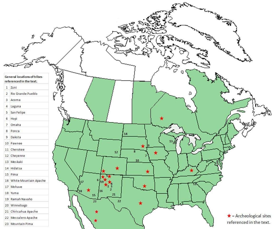
Map 2. Sites of documented use of Physalis species
Map 2, from the USDA Natural Resources Conservation Service, shows sites of documented use of Physalis species in North America. The range of all Physalis species is in green. Tribes who used these species for food or medicine are listed and numbered; archeological sites where Physalis seeds have been found are indicated with stars. These sites and areas are referenced in a forthcoming paper on the Native American ethnobotany (cultural use) of Physalis longifolia and related species.

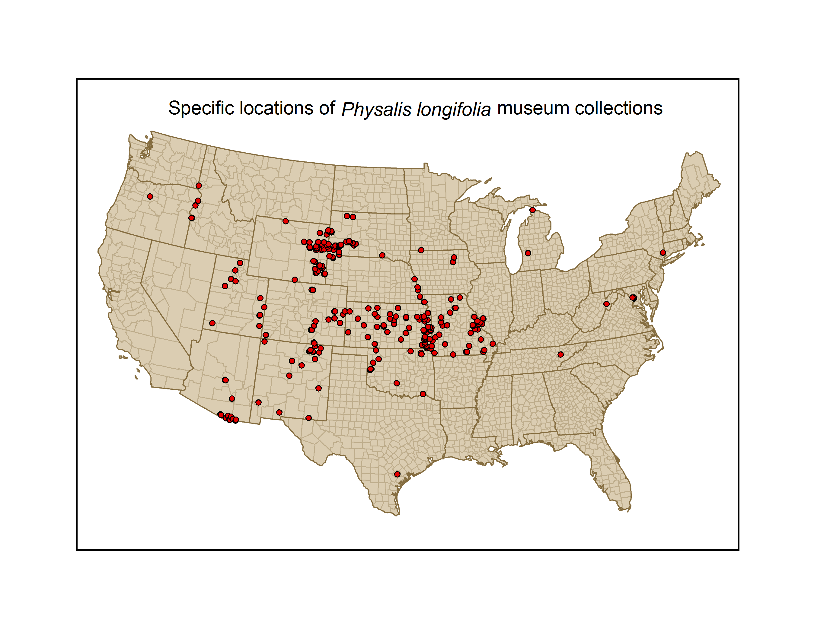
Map 3. Physalis longifolia museum collections
Map 3 shows locations where Physalis longifolia voucher specimens are located in herbaria and botanical museums.